OURBIZ-US Shop
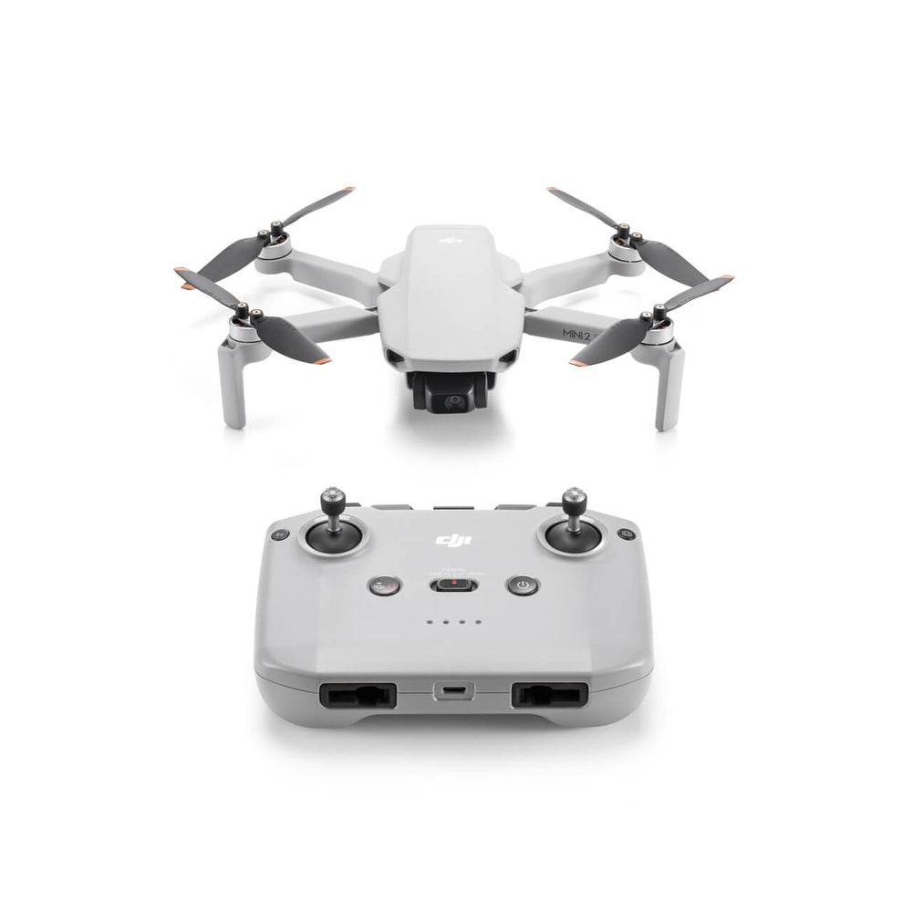
DJI Mini 2 SE
About this product
Description
The DJI Mini 2 SE is a lightweight and compact drone, perfect to accompany you on your hikes and travels. With a flight time of up to 31 minutes, you can capture stunning aerial moments from anywhere. With the Combo, you'll get two additional batteries for a total of 93 minutes of flight time.

With the DJI Fly app featuring easy-to-use shooting templates, you'll be able to fly, record, and generate professional-grade videos that can be shared directly on your social media. Additionally, it features DJI OcuSync, offering enhanced transmission and greater anti-interference capability for flying and capturing even further.
You'll be able to reliably and stably capture content in a wide variety of conditions. Thanks to its ability to fly in winds of up to 23.6 mph, you can take your creativity to new heights in places that were previously not possible. Experience exceptional stability with the DJI Mini 2 SE.

Learning to fly a drone is quick and easy thanks to its simplified operations, ideal for beginners. Enjoy a worry-free flying experience while exploring the world from a unique perspective. Also, make sure to download the latest version of DJI Fly from the official website for a better user experience.
Technical Specifications
|
Aircraft |
|
|
Takeoff Weight |
246 g (Standard aircraft weight (including Intelligent Flight Battery, propellers, and a microSD card). Actual product weight may vary due to differences in batch materials and external factors. No training or examination is required to fly this product in most countries and regions. Always check local laws and regulations before use.) |
|
Dimensions |
Folded (without propellers): 138×81×58 mm (L×W×H) |
|
|
Folded (without propellers): 138×81×58 mm (L×W×H) |
|
|
Unfolded (with propellers): 245×289×56 mm (L×W×H) |
|
Max Flight Distance |
15.7 kilometers |
|
Max Ascent Speed |
5 m/s |
|
Max Descent Speed |
3.5 m/s |
|
Max Horizontal Speed (at sea level, no wind) |
16 m/s (Maximum horizontal speed is subject to local dynamic restrictions. Please comply with local laws and regulations when flying.) |
|
Max Takeoff Altitude |
4000 m (2000 m when taking off with propeller guards.) |
|
Max Flight Time |
31 minutes (Measured in a controlled test environment. Specific test conditions are as follows: flying forward at a constant speed of 17 km/h in a windless laboratory environment, in photo mode (no photo shooting operation during flight) and from 100% battery level until 0%. Results may vary depending on the environment, actual use, and firmware version.) |
|
Max Wind Speed Resistance |
10.7 m/s (Level 5) |
|
Max Tilt Angle |
40° |
|
Operating Temperature |
0° to 40° C (32° to 104° F) |
|
Global Navigation Satellite System |
GPS + GLONASS + Galileo |
|
Hovering Accuracy Range |
Vertical: |
|
|
±0.1 m (with vision positioning) |
|
|
±0.5 m (with GNSS positioning) |
|
|
Horizontal: |
|
|
±0.3 m (with vision positioning) |
|
|
±1.5 m (with GNSS positioning) |
|
Internal Storage |
N/A |
|
Class |
C0 (EU) |
|
Camera |
|
|
Image Sensor |
1/2.3-inch CMOS, effective pixels: 12 MP |
|
Lens |
Field of View (FOV): 83° |
|
|
Equivalent Format: 24 mm |
|
|
Aperture: f/2.8 |
|
|
Focus: 1 m to ∞ |
|
ISO Range |
Video: 100-3200 |
|
|
Photo: 100-3200 |
|
Shutter Speed |
Electronic Shutter: 4-1/8000 s |
|
Max Image Size |
4000×3000 |
|
Still Photography Modes |
Single Shot: 12 MP |
|
|
Timed: 12 MP |
|
|
JPEG: 2/3/5/7/10/15/20/30/60 s |
|
|
JPEG + RAW: 5/7/10/15/20/30/60 s |
|
|
Auto Exposure Bracketing (AEB): 12 MP, 3 frames at 2/3 EV bias |
|
|
Panorama: Sphere, 180°, and Wide Angle |
|
Photo Format |
JPEG/DNG (RAW) |
|
Video Resolution |
2.7K: 2720×1530 at 24/25/30 fps |
|
|
FHD: 1920×1080 at 24/25/30/48/50/60 fps |
|
Video Format |
MP4 (MPEG-4 AVC/H.264) |
|
Max Video Bitrate |
40 Mbps |
|
Supported File System |
FAT32 (≤ 32 GB) |
|
|
exFAT (> 32 GB) |
|
Digital Zoom |
2.7K: 3× |
|
|
FHD: 4× |
|
Color Mode |
Normal |
|
QuickShots Modes |
Dronie, Helix, Rocket, Circle, and Boomerang |
|
Gimbal |
|
|
Stabilization |
3-axis mechanical gimbal (tilt, roll, and pan) |
|
Mechanical Range |
Tilt: -110° to 35° |
|
|
Roll: -35° to 35° |
|
|
Pan: -20° to 20° |
|
Controllable Range |
Tilt: |
|
|
-90° to 0° (default) |
|
|
-90° to 20° (extended) |
|
Max Control Speed (tilt) |
100°/s |
|
Angular Vibration Range |
±0.01° |
|
Sensing |
|
|
Downward |
Precise hovering range: 0.5-10 m |
|
Operating Environment |
Downward: |
|
|
surfaces with discernible patterns, diffuse reflectivity >20% (e.g., walls, trees, people), and adequate illumination (lux >15) |
|
Video Transmission |
|
|
Video Transmission System |
DJI O2 |
|
Live View Quality |
Remote Controller: |
|
|
720p/30fps |
|
Operating Frequency |
2.400-2.4835 GHz |
|
|
5.725-5.850 GHz |
|
Transmitter Power (EIRP) |
2.400-2.4835 GHz: |
|
|
< 26 dBm (FCC) |
|
|
< 20 dBm (CE/SRRC/MIC) |
|
|
|
|
|
5.725-5.850 GHz: |
|
|
< 26 dBm (FCC/SRRC) |
|
|
< 14 dBm (CE) |
|
Max Transmission Distance (unobstructed, free of interference) |
FCC: 10 km |
|
|
CE: 6 km |
|
|
SRRC: 6 km |
|
|
MIC: 6 km |
|
|
Measured in an unobstructed outdoor environment free of interference. The above data shows the furthest communication range for one-way flights without return, according to each standard. During flight, pay attention to the RTH reminders in the DJI Fly app. |
|
Max Transmission Distance (with interference) |
Strong interference: urban landscape, approx. 1.5-3 km |
|
|
Medium interference: suburban landscape, approx. 3-6 km |
|
|
Low interference: suburb/coast, approx. 6-10 km |
|
|
Data tested according to FCC standard in unobstructed environments with typical interference. Used for reference only and does not guarantee actual flight distance. |
|
Lowest Latency |
Approx. 200 ms |
|
|
Depending on the actual environment and mobile device. |
|
Battery |
|
|
Capacity |
2250 mAh |
|
Weight |
82.5 grams |
|
Nominal Voltage |
7.7 volts |
|
Max Charging Voltage |
8.8 volts |
|
Type |
Li-ion battery |
|
Energy |
17.32 Wh |
|
Charging Temperature |
5° to 40° C (41° to 104° F) |
|
Battery Charging Hub |
|
|
Input |
5 V, 3 A |
|
|
9 V, 3 A |
|
|
12 V, 3 A |
|
Output |
USB-A: |
|
|
Max. Voltage: 5 V; Max. Current: 2 A |
|
Charging Type |
Three batteries charged in sequence |
|
Storage |
|
|
Recommended microSD Cards |
16 GB: |
|
|
SanDisk Extreme |
|
|
|
|
|
32 GB: |
|
|
Samsung PRO Endurance |
|
|
Samsung EVO Plus |
|
|
SanDisk Industrial |
|
|
SanDisk Extreme V30 A2 |
|
|
SanDisk Extreme Pro V30 A1 |
|
|
SanDisk Extreme Pro V30 A2 |
|
|
Lexar 633x |
|
|
Lexar 667x |
|
|
|
|
|
64 GB: |
|
|
Samsung PRO Endurance |
|
|
Samsung EVO Plus |
|
|
SanDisk Extreme V30 A1 |
|
|
SanDisk Extreme V30 A2 |
|
|
Lexar 633x |
|
|
Lexar 667x |
|
|
Lexar 1000x |
|
|
Lexar High Endurance |
|
|
Toshiba EXCERIA M303 V30 A1 |
|
|
Netac Pro V30 A1 |
|
|
|
|
|
128 GB: |
|
|
Samsung EVO Plus |
|
|
SanDisk Extreme V30 A2 |
|
|
SanDisk Extreme Plus V30 A1 |
|
|
SanDisk Extreme Plus V30 A2 |
|
|
Lexar 633x |
|
|
Lexar 667x |
|
|
Lexar 1000x |
|
|
Lexar High Endurance |
|
|
Toshiba EXCERIA M303 V30 A1 |
|
|
Netac Pro V30 A1 |
|
|
|
|
|
256 GB: |
|
|
SanDisk Extreme V30 A2 |
|
Remote Controller |
|
|
Max Operating Time |
DJI RC-N1 Remote Controller |
|
|
Without charging any mobile device: 6 hours |
|
|
When charging a mobile device: 4 hours |
|
Max. Supported Mobile Device Size |
DJI RC-N1 Remote Controller |
|
|
180 × 86 × 10 mm (length × width × height) |
|
Operating Temperature |
DJI RC-N1 Remote Controller |
|
|
-10° to 40° C (14° to 104° F) |
|
Transmitter Power (EIRP) |
DJI RC-N1 Remote Controller |
|
|
2.400-2.4835 GHz: |
|
|
< 26 dBm (FCC) |
|
|
< 20 dBm (CE/SRRC/MIC) |
|
|
|
|
|
5.725-5.850 GHz: |
|
|
< 26 dBm (FCC) |
|
|
< 23 dBm (SRRC) |
|
|
< 14 dBm (CE) |
|
Miscellaneous |
|
|
Guaranteed software updates until |
31/12/2026 |
Box Contents
- 1 DJI Mini SE Aircraft with Battery
- 1 DJI RC-N1 Remote Controller
- 1 Accessory Box (propellers + RC cables + screwdriver + charging cable)
